
Buffalo Skyway Corridor Competition Project Resources
Potential respondents can review the City’s land use policies and regulations at the following websites:
- Buffalo Comprehensive Plan
- Buffalo Green Code
- Buffalo Local Waterfront Revitalization Program (LWRP)
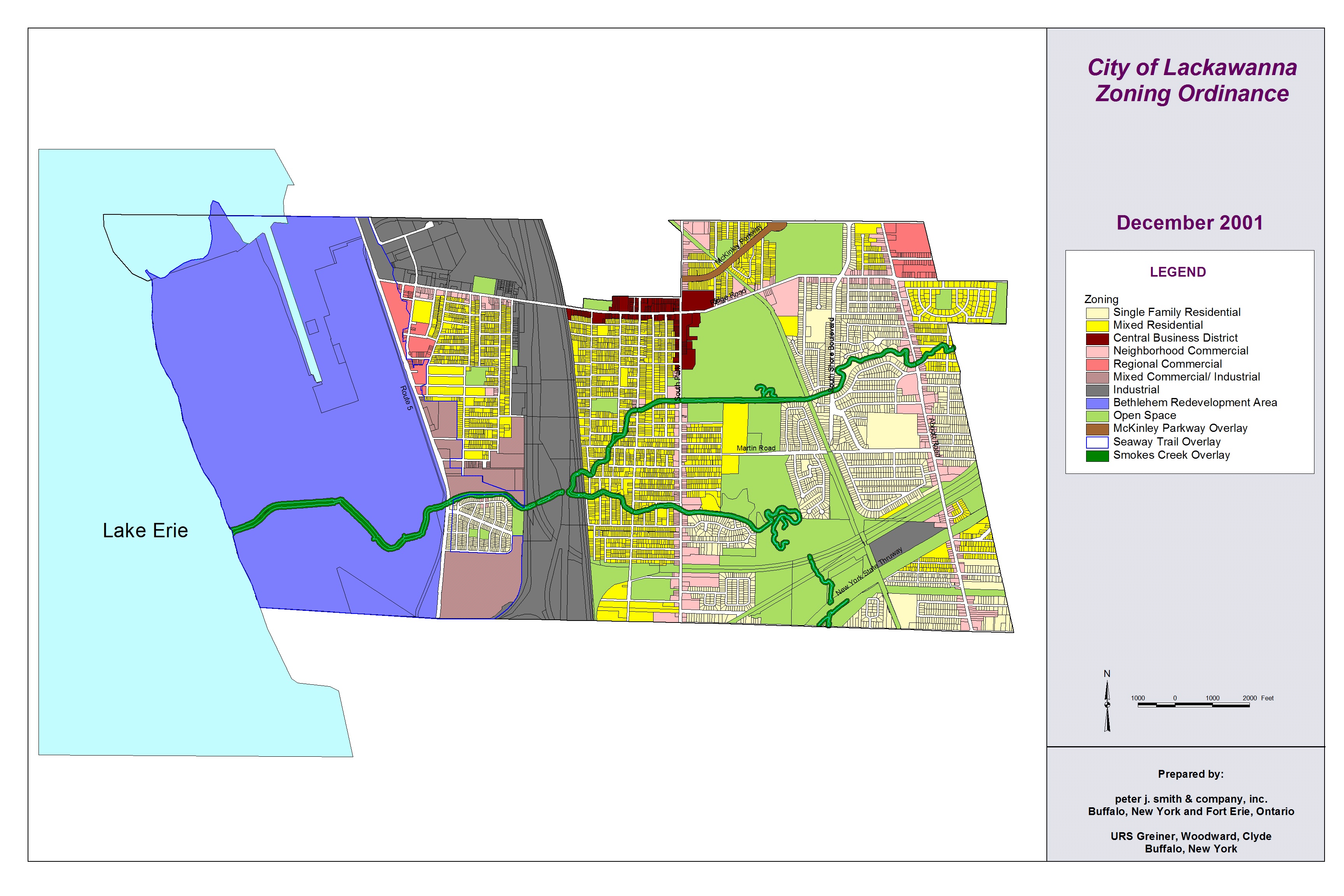
- City of Lackawanna Zoning Map & Ordinance
Potential respondents can review transportation demand model runs from Greater Buffalo-Niagara Regional Transportation Council here:
- Skyway Scenarios Transportation Demand Model Output
- GBNRTC 2019 Skyway Traffic Scenario Analyses Summary
- Where to Access GBNRTC Traffic Count Data
Potential respondents can review past New York State Department of Transportation reports and studies here:
- 2005-06 Southtowns Connector – Buffalo Outer Harbor DR-FEIS
- 2008 Buffalo Skyway Bridge Management Study (Bergmann Assoc.)
- 2013-2014 Skyway Plausibility Review
- 2017 Skyway Deck Rehab Design Report
Potential respondents can review/download New York State Department of Transportation Record Plans (i.e., “As-Built Drawings) for the 2007 Southtowns Connector – Buffalo Outer Harbor Project here:
- Southtowns Connector – Buffalo Outer Harbor Project, As-Built Drawings – General Plans and Profiles
- Southtowns Connector – Buffalo Outer Harbor Project, As-Built Drawings – Grading
- Southtowns Connector – Buffalo Outer Harbor Project, As-Built Drawings – Landscape
Base mapping of Skyway Corridor:
ESD-provided base mapping of the corridor is not available, however potential respondents may elect to access online base map resources available in .DXF (Drawing Exchange) format (which may be imported into AutoCAD, Rhinoceros, SketchUp or Adobe Illustrator graphic programs), at websites such as: https://cadmapper.com/
**Please note that ESD does not guarantee the accuracy of such online base mapping resources.
Aim for the Sky RFS Images
Images from the ‘Aim for the Sky: Competition to Re-Imagine the Buffalo Skyway Corridor’ RFS can be found here: RFS Images
If you need high-resolution images, please email [email protected] with description and page number of the image you need.
Base Map & Images in Vicinity of Skyway & I-190 Interchange:
AutoCAD and Adobe Acrobat base maps and images of land areas under the Skyway in the vicinity of its interchange with I-190 can be found here: Skyway/I-190.